|
WAESC Aust Wetland Inventory Share-Point Site |
National Mapping and Query Tools
It is possible to access the DIWA and Ramsar datasets via a number of online tools.
- Austraian Wetlands Database tool Search by Ramsar or DIWA site
- Spatial query tool
- National Map
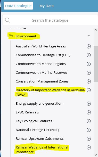
Re: use of National Map. To do this you need to add the layers to the mapping application.
- Click Add Data
- Under Environment Folder in the Data Catalogue slelect the DIWA and Ramsar Wetlands of International Importance layers
- Click 'Add to Map'
- The DIWA and Ramsar layers are now available in the layer manager
- Check DIWA and Ramsar to display them in Map Legend to toggle on/off or change opacity

Click here to access the National Map application Note: Map Maker will open in a new window(and the DIWA and Ramsar layers should be pre-loaded)